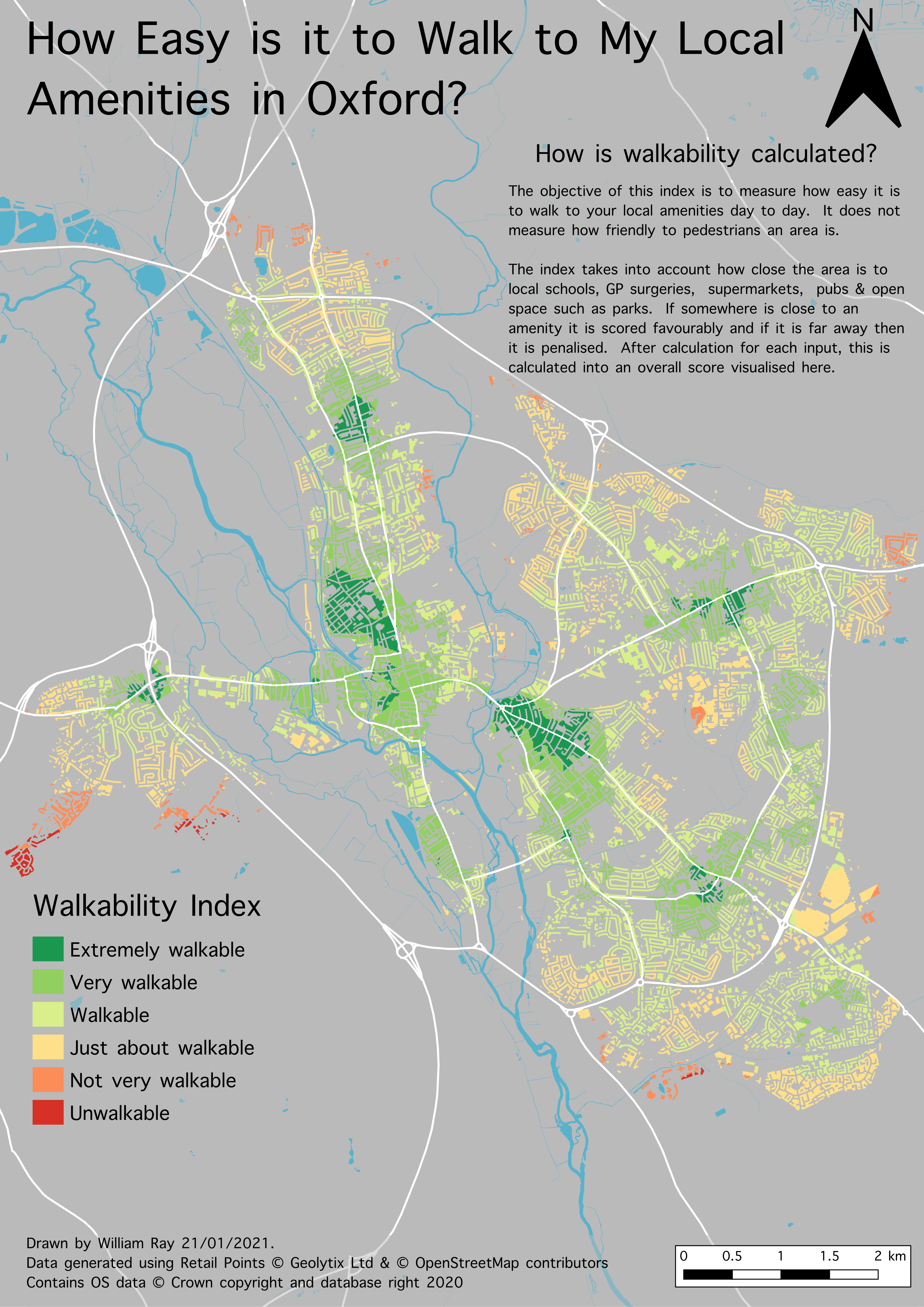
The accessibility of local amenities is one way that you can measure how feasible it is to walk around your local neighbourhood during your everyday activities.
Supported by Cyclox member Will Ray, CoHSAT explored the walkability of Oxford. Will, who is a geographer and spacial mapper, created a draft Walkability Index of Oxford City, using proximity to supermarkets, green space (parks, playing fields and allotments), pubs, schools and GP surgeries. Will produced the below map rating streets in terms of their walkability.
From this map you can see that the most walkable areas in the city are near district centres, Summertown, Jericho, Cowley Road, Temple Cowley, Headington. The areas with the least workable areas tend to be in the peripheries of the city, and several are in the more deprived parts of the city, Blackbird Leys, Cowley and Barton. The lack of local amenities probably contributes to making these places less desirable to live in and locking in car dependency in those communities that can least afford a car.
CoHSAT will build on this work with our 2021-2022 projects on 15 minute neighbourhoods.
Read the full report on this project.
Open Street Map was used to create a “network” to perform the analysis on including roads, local footpaths and rights of way. Data on schools, GP surgeries and pubs was collected from Open Street Map. Open Map Greenspace provided data on open space, and the Geolytix Retail Points dataset was used to locate supermarkets.
Isoarea analysis used to understand the distance to the different amenities, based on Google’s standard walking speed of 4.5km/hr. We then identified 5 distance groups and allocated each a score of 1 to 5. This was repeated for all five amenities and combined into an overall score. This contained scores of 5-25 as there were five inputs into the model. This was then split into 5 classes.
Score | Label | Definition |
5 | Extremely Walkable | All amenities are within a 500m walk |
6 -7 | Very Walkable | Most amenities are within 500m walking distance but some are further away. |
8 -10 | Walkable | All amenities are within 1km walking distance |
11-15 | Just about Walkable | Amenities will be around 1km away, some maybe further away. |
16 -21 | Not very Walkable | Almost all amenities are will be 1-1.5km walk away or further. |
22-25 | Unwalkable | Most amenities are over 2km walk. |
